Places of Amnesia
-
Dates2017 - Ongoing
-
Author
- Locations Tokyo, Japan, Sumida City, Mukojima
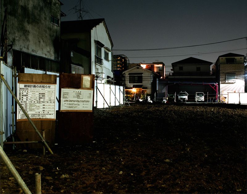
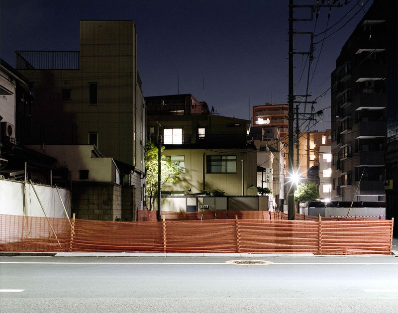
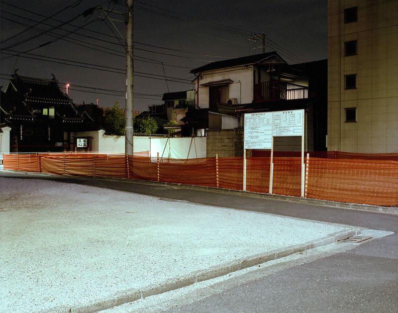
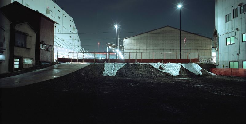
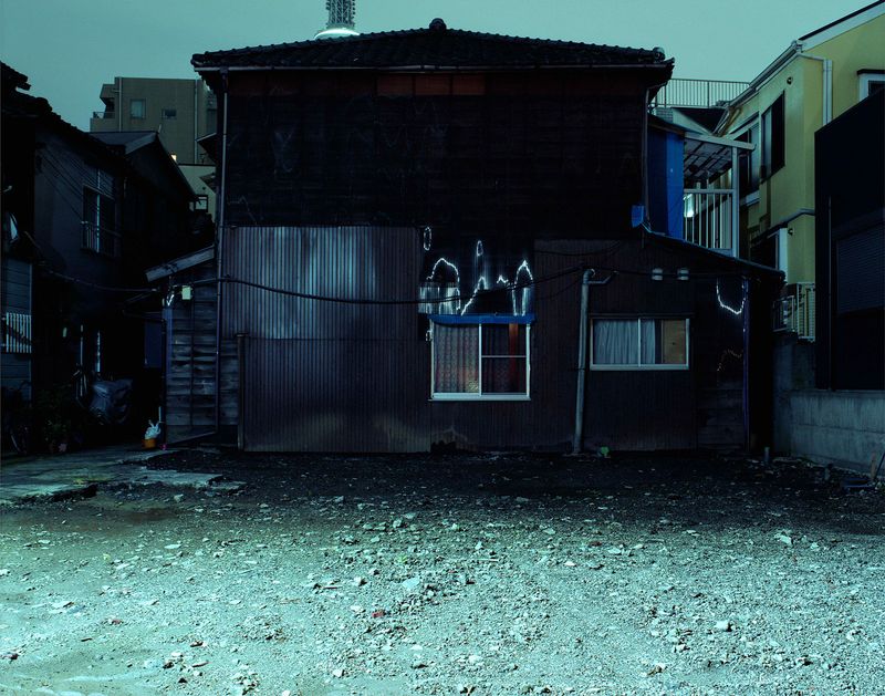
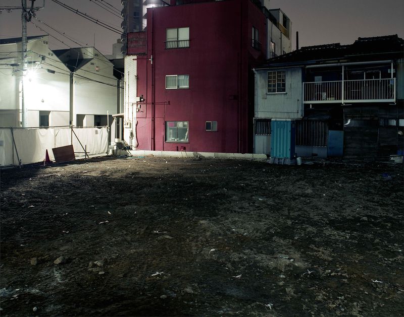
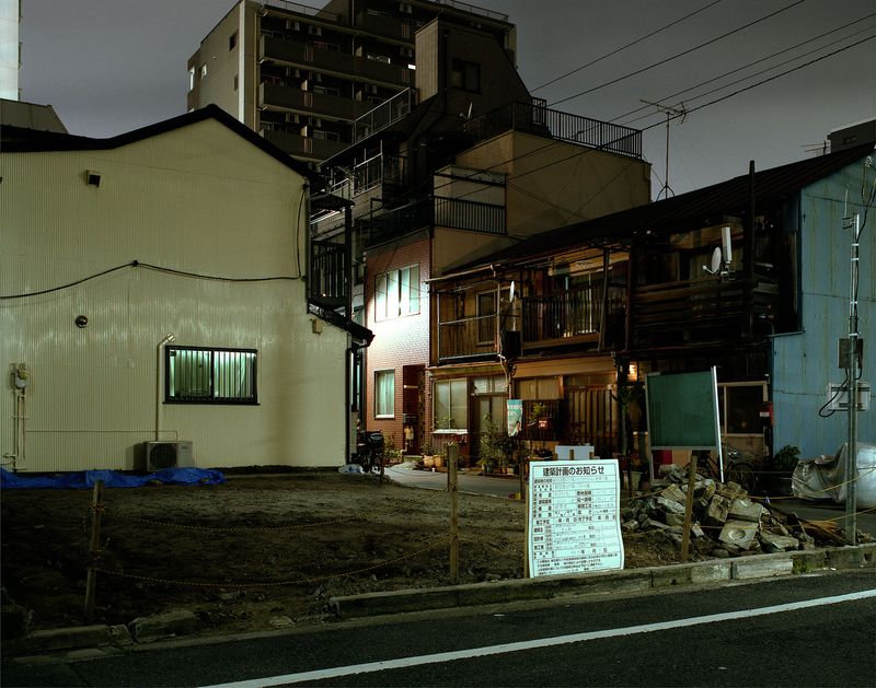
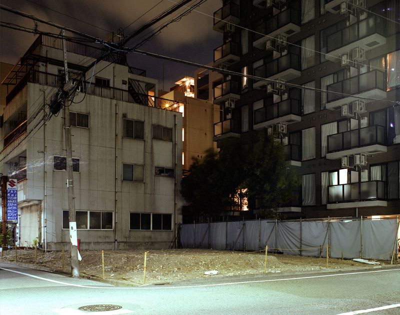
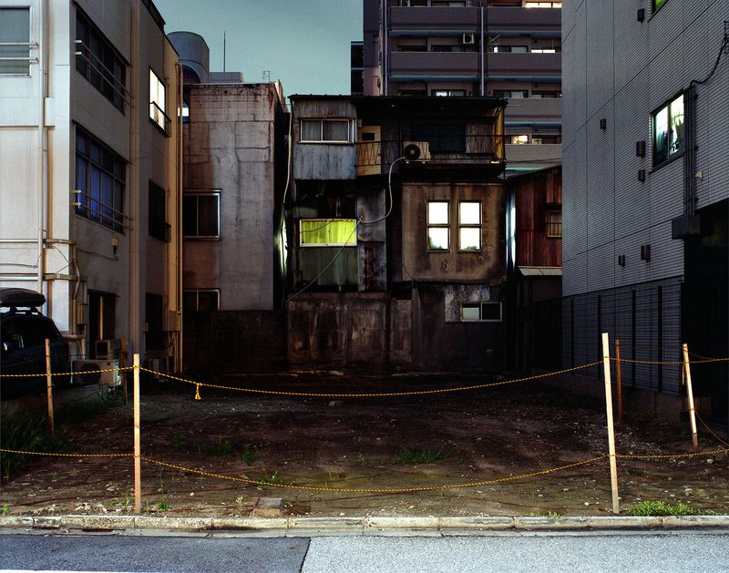
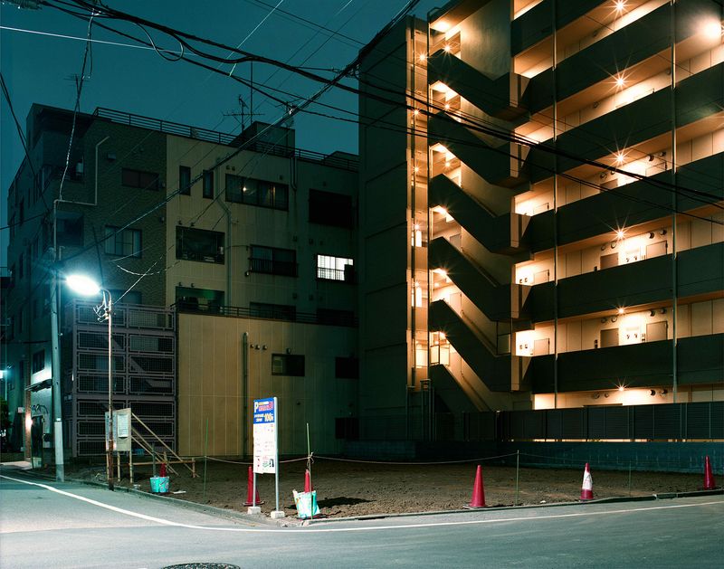
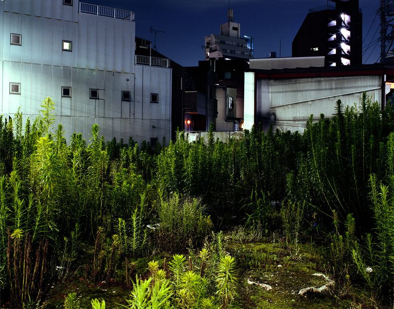
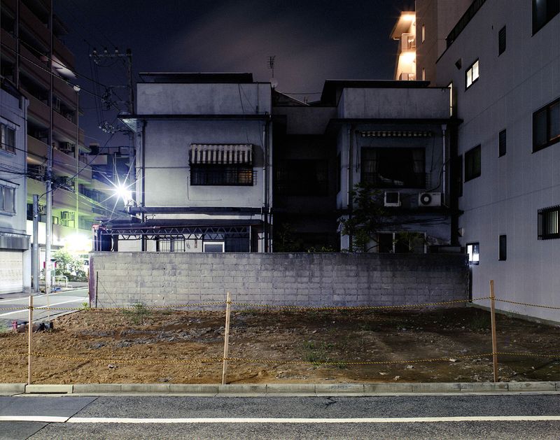
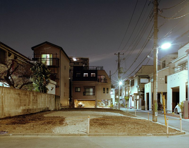
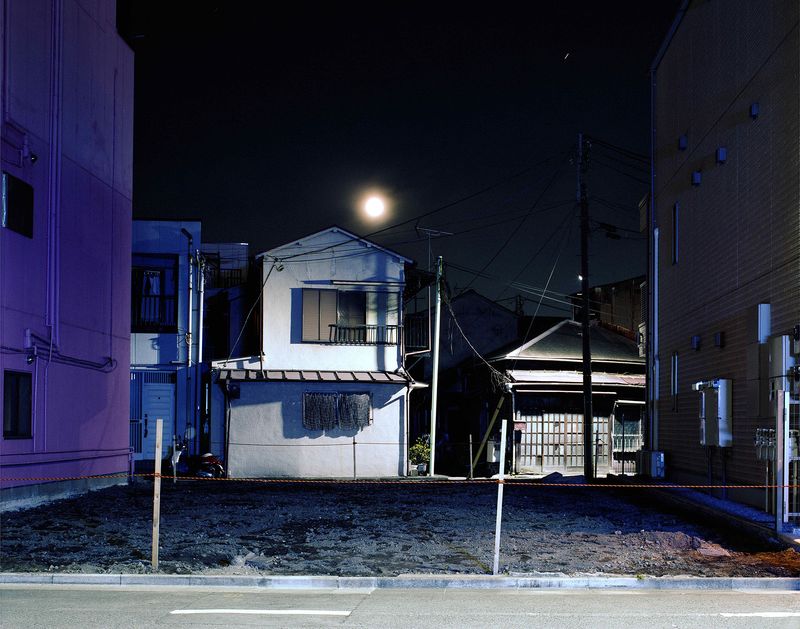
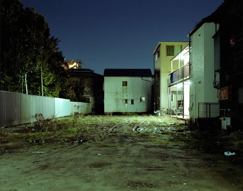
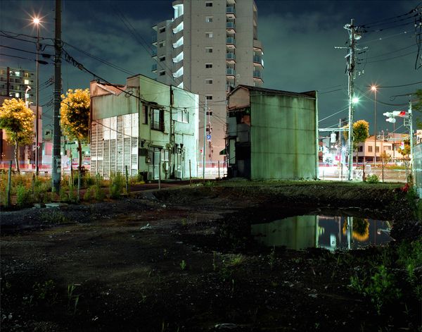
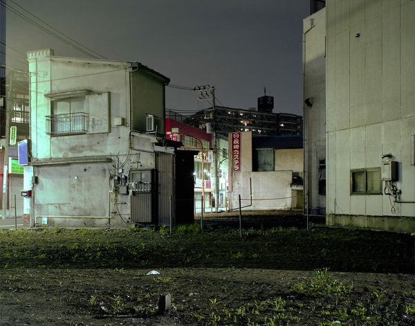
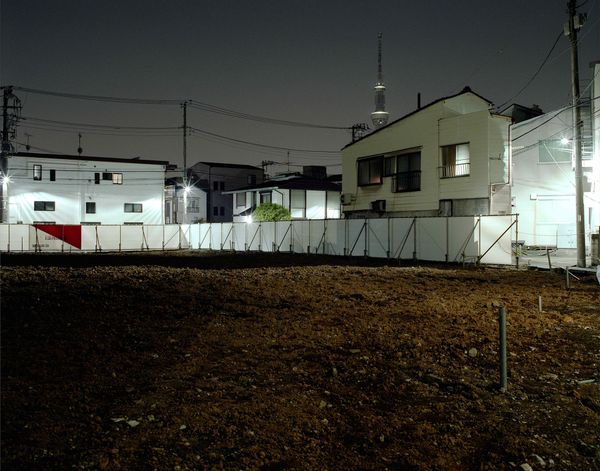
This series documents over 80 vacant lots in Mukojima, Tokyo, photographed at night over seven years. It explores how demolition disrupts the relationship between land and memory, leaving behind silent spaces where the spirit of place has vanished.
Statement
Belief in guardian spirits of the land exists across many cultures. In Japan’s Shinto tradition, such deities are known as jinushi-no-kami (landowner gods), and even today, groundbreaking ceremonies called jichinsai are still held before construction begins—evidence of how deeply rooted land spirituality remains. In contrast, one of the best-known land spirits in Western traditions is the genius loci, the guardian spirit of a place from ancient Roman mythology.
Italian architect Aldo Rossi, in his book The Architecture of the City, described genius loci as the mediator that forges a unique yet universal relationship between a place and the structures upon it. According to Rossi, it is the built form that bears the memory of a place, and "place" itself is defined by a complex interplay of space, time, geography, form, historical layers, and memory.
Turning our attention to contemporary Japanese cities, we see a stark contrast: while spiritual reverence for land persists, buildings tend to be treated as disposable consumer goods—demolished and replaced according to economic logic. Across Japan, this has led to streetscapes increasingly devoid of character. The constant cycle of “scrap and build” has prevented new structures from developing the kind of profound relationship with their sites that Rossi described. This phenomenon echoes what architect Rem Koolhaas termed the "Generic City"—urban environments stripped of identity.
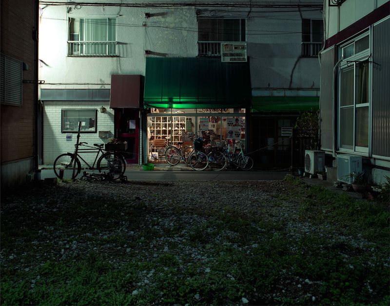
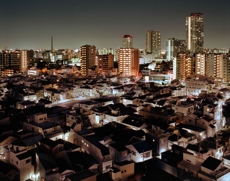
Located in northeastern Tokyo, the Mukojima district long stood apart from the rapid and dramatic redevelopment seen in central Tokyo. It retained a strong sense of memory, with numerous buildings from both before and after the war still standing. However, over the past decade, this area too has changed significantly. Since sensing a wave of rapid transformation in the spring of 2017, I began marking newly created vacant lots on Google Maps. Between June 2017 and April 2024, I recorded 638 such sites—together covering over 20 hectares of land. Though the real estate boom leading up to the 2021 Olympics has since slowed slightly, the appearance of new empty lots continues unabated.
Even if land and architecture together nurture a sense of place over time, when we stand before a vacant lot, we often cannot recall what once stood there. This seems to affirm Rossi’s claim that place is not inherent to the land itself, but rather emerges from the relationship between land and building.
This project presents a record of vacant lots observed over seven years. In the context of urban development, each demolition and rebuilding erases and overwrites the memory of place. A vacant lot, then, is the "and" in the phrase "scrap and build"—a fleeting moment of absence in the long continuum of a city’s history. There is, unsurprisingly, nothing present in these spaces. No genius loci, no clear sense of place. And yet, the discomfort that lingers in these hollowed-out gaps may paradoxically underscore the very significance of place.
About Mukojima
Mukojima is a district located in northeastern Tokyo. Known for its maze-like network of narrow alleyways—remnants of old footpaths and waterways—it also served as the setting for writer Nagai Kafū’s classic novel Bokutō Kidan (A Strange Tale from East of the River).
According to the Ansei Newly Revised Map of the Sumida River and Mukojima (1856), the area referred to as Mukojima during the Edo period was bounded by the Sumida River to the west, the Ayase River and Nakagawa (now Old Nakagawa) to the east, and the Kita-Jukken River to the south. Today, the name generally refers to a roughly triangular river island about four kilometers on each side, bordered by the Sumida River to the west, the Arakawa River to the east, and the Yokojikken and Old Nakagawa Rivers to the south.
Interestingly, “Mukojima” was not originally a place name, but a colloquial expression referring to the far bank of the Sumida River as seen from Edo (present-day central Tokyo). Among various theories about the name’s origin, the most plausible suggests that the area appeared as an “island” (shima) when viewed from the western bank of the river. This interpretation resonates with the district’s distinctly different atmosphere and urban character, which contrast with the Tokyo metropolis and evoke the nuance of kawa-mukō—a Japanese phrase implying both physical separation and cultural difference, or “the other side of the river.”
During the mid-Edo period, Mukojima gained fame as a leisure destination after the eighth shogun, Tokugawa Yoshimune, ordered cherry trees to be planted along the river embankments, transforming the area into a renowned hanami (cherry blossom viewing) spot. It continued to flourish as a recreational area into the Meiji period, while also developing into an industrial hub thanks to its riverine location, which favored water transport. Despite suffering damage during the 1923 Great Kantō Earthquake and the 1945 Tokyo air raids, Mukojima rebuilt itself as a dense, mixed-use neighborhood, blending residential, commercial, industrial, and leisure spaces.
However, after the economic bubble burst in the early 1990s and broader societal shifts took place, the number of factories—which once peaked at over 9,000—declined to around 2,000. Likewise, the once-vibrant hanamachi (entertainment district), which boasted over 100 traditional restaurants and teahouses at its height, has significantly diminished. Today, Mukojima appears to be in a transitional phase: shifting away from its historically mixed-use fabric toward a more residential character, signaling a broader transformation in the area’s social and urban functions.