Geography of Domination

  • Dates
    2021 - Ongoing
  • Author
  • Locations Saudi Arabia, Egypt, Morocco

A poetic way of showing human violence through satellite imagery.

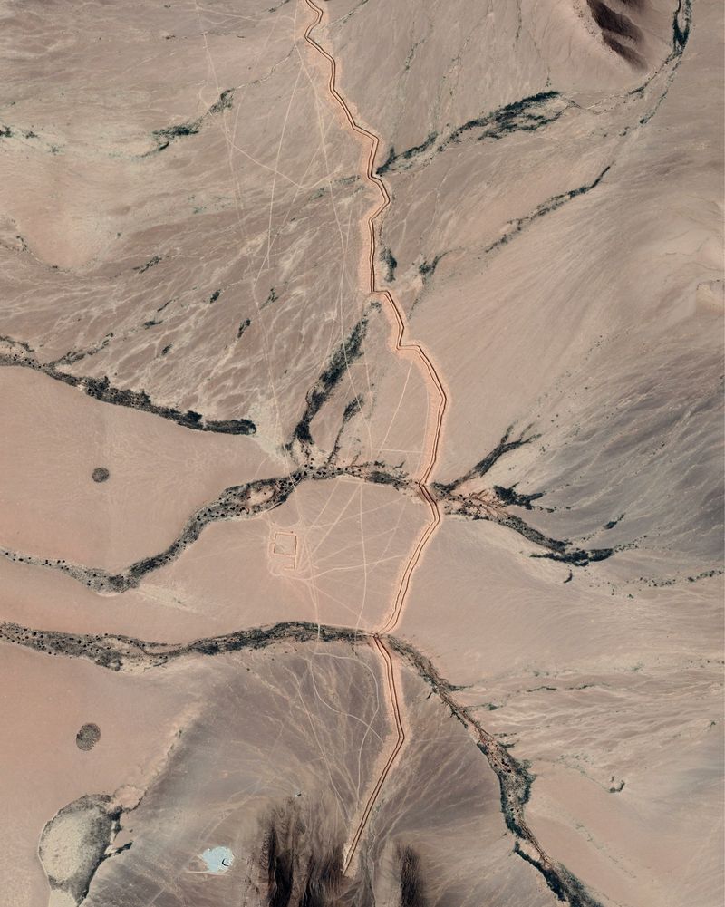
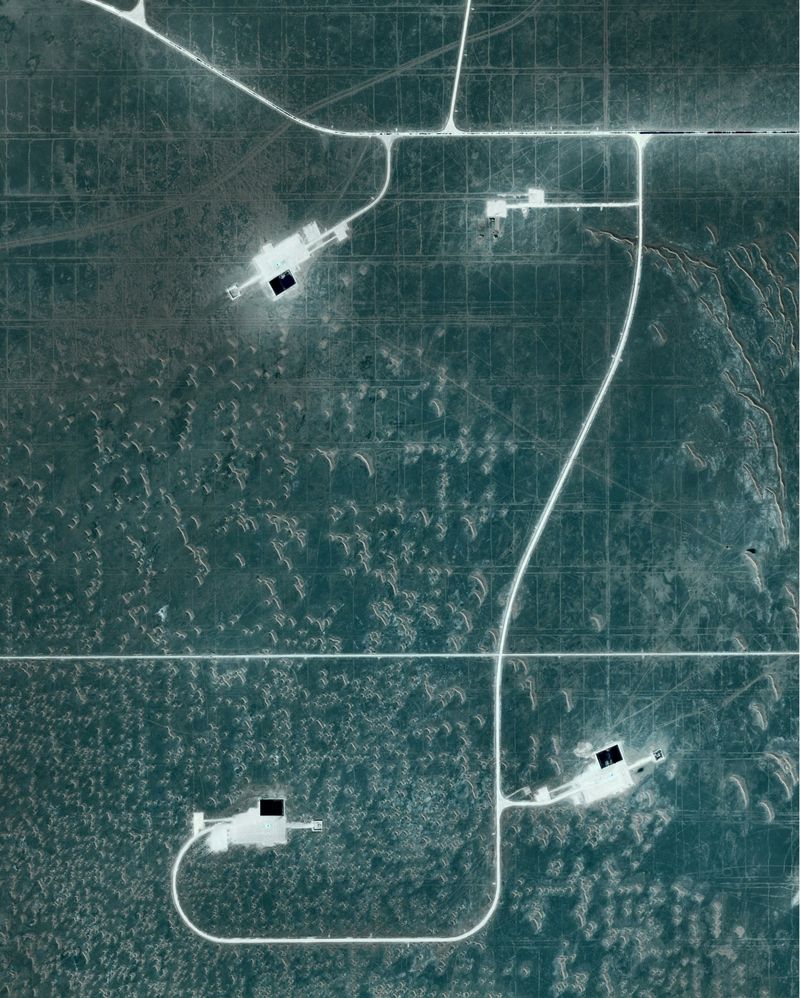
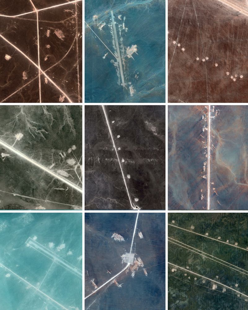
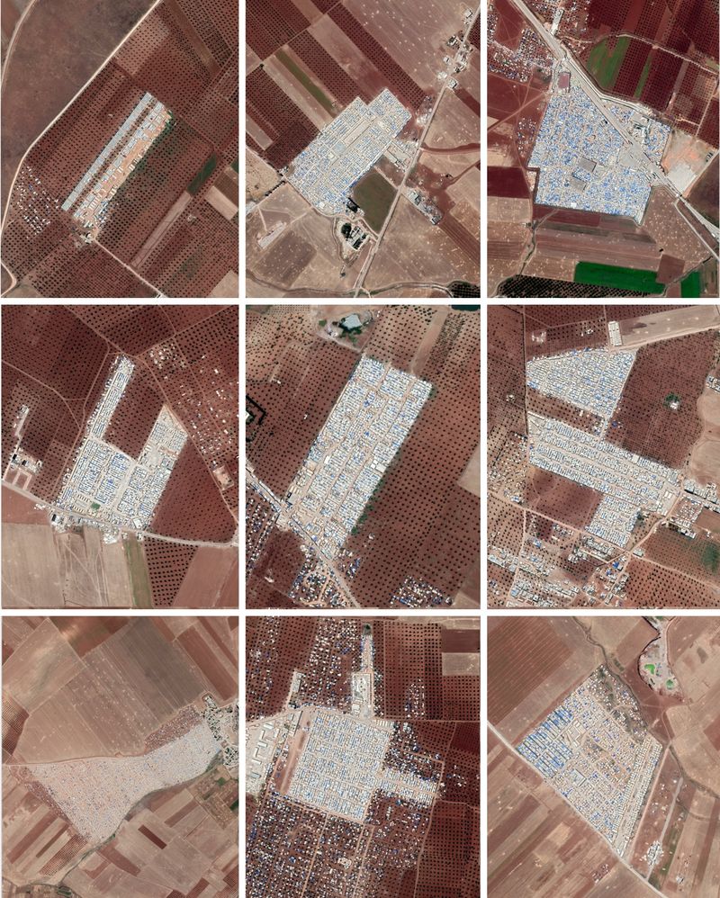
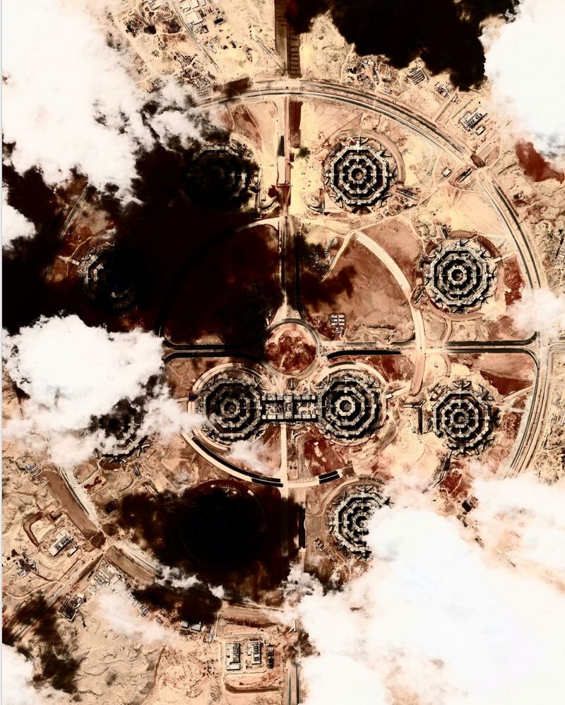
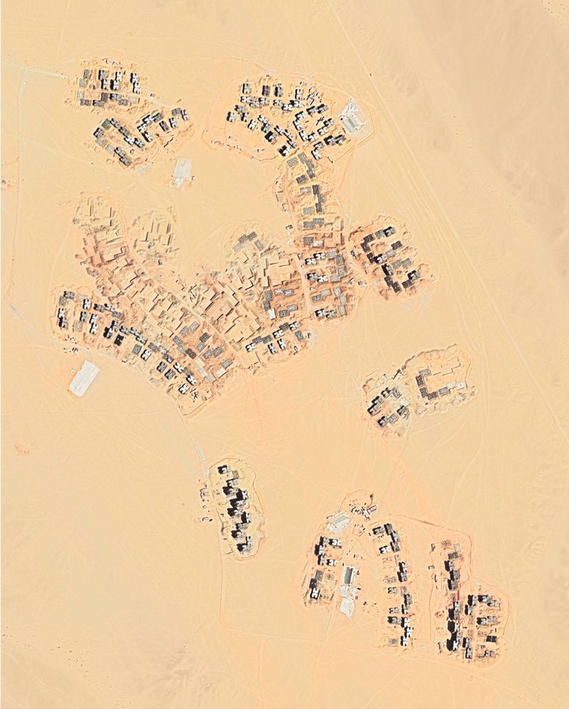
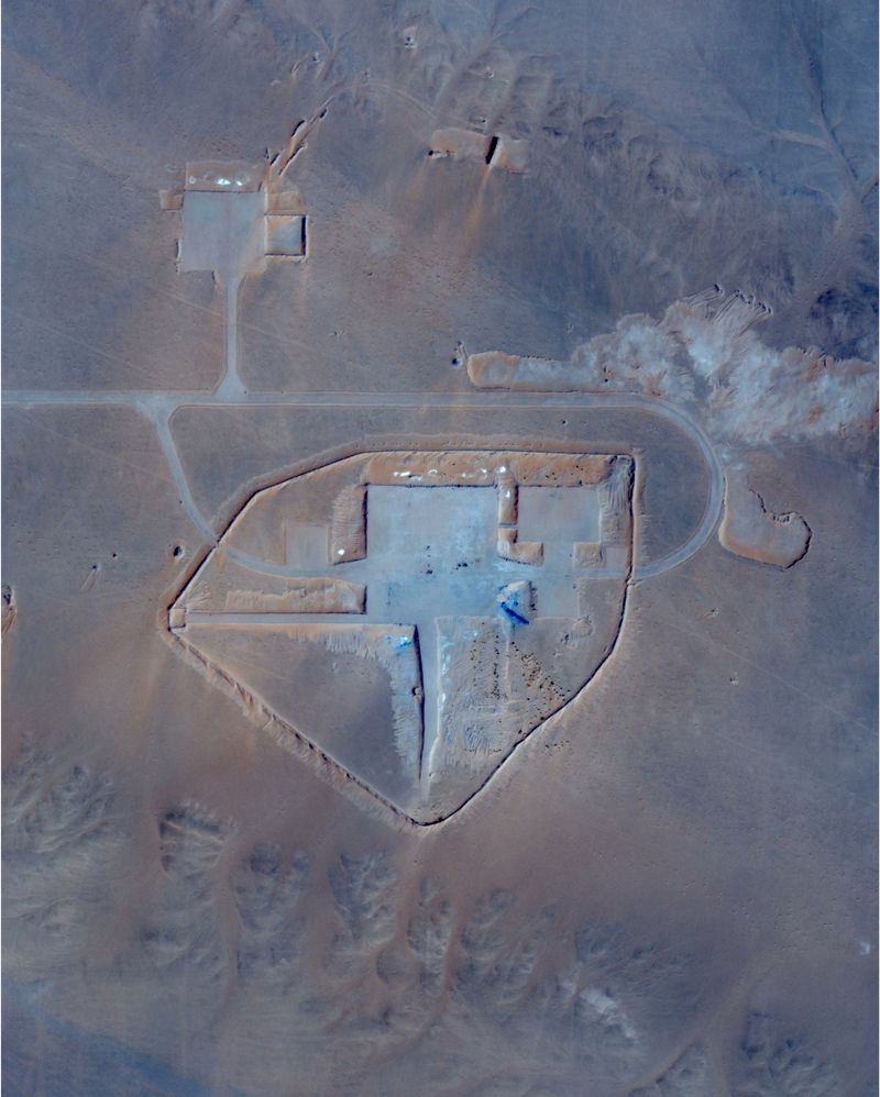
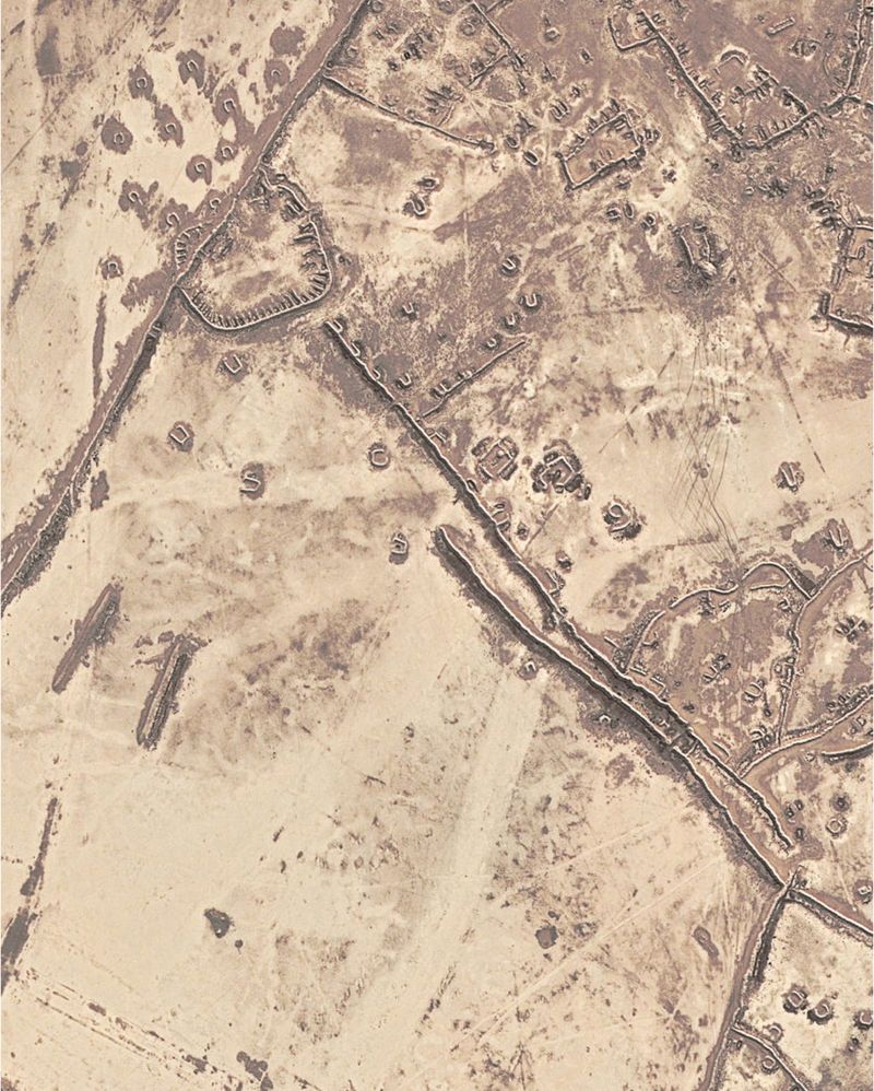
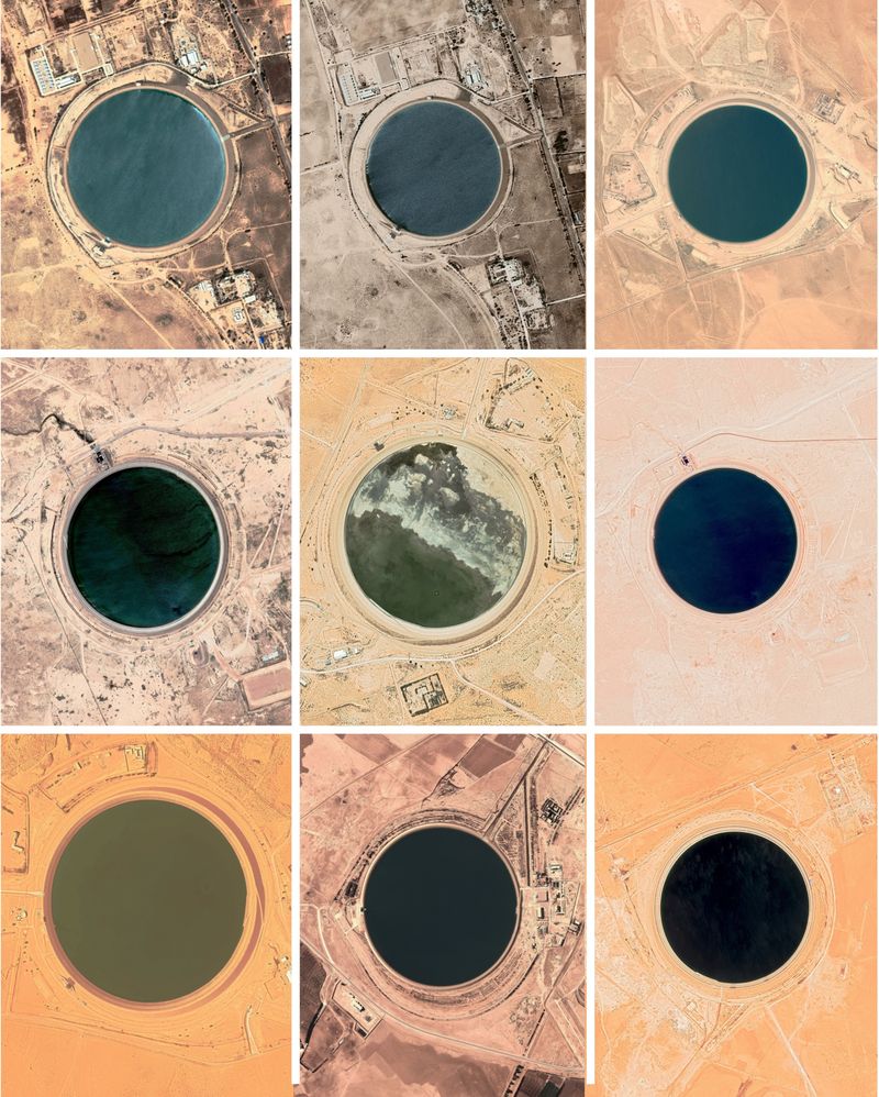
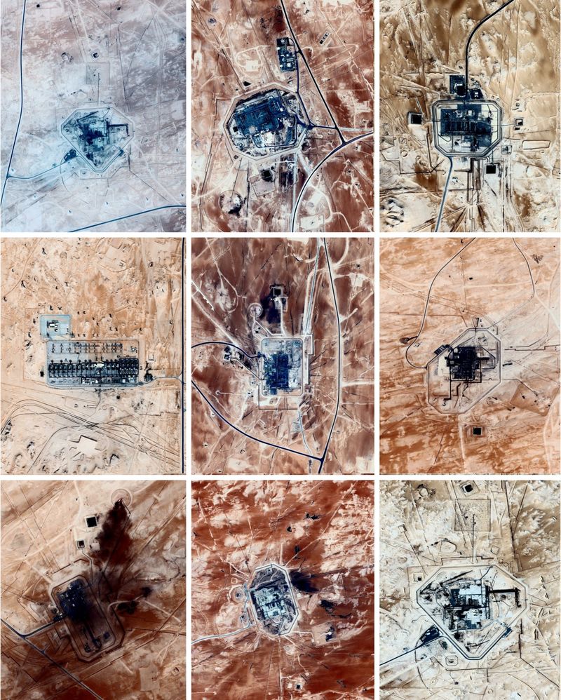
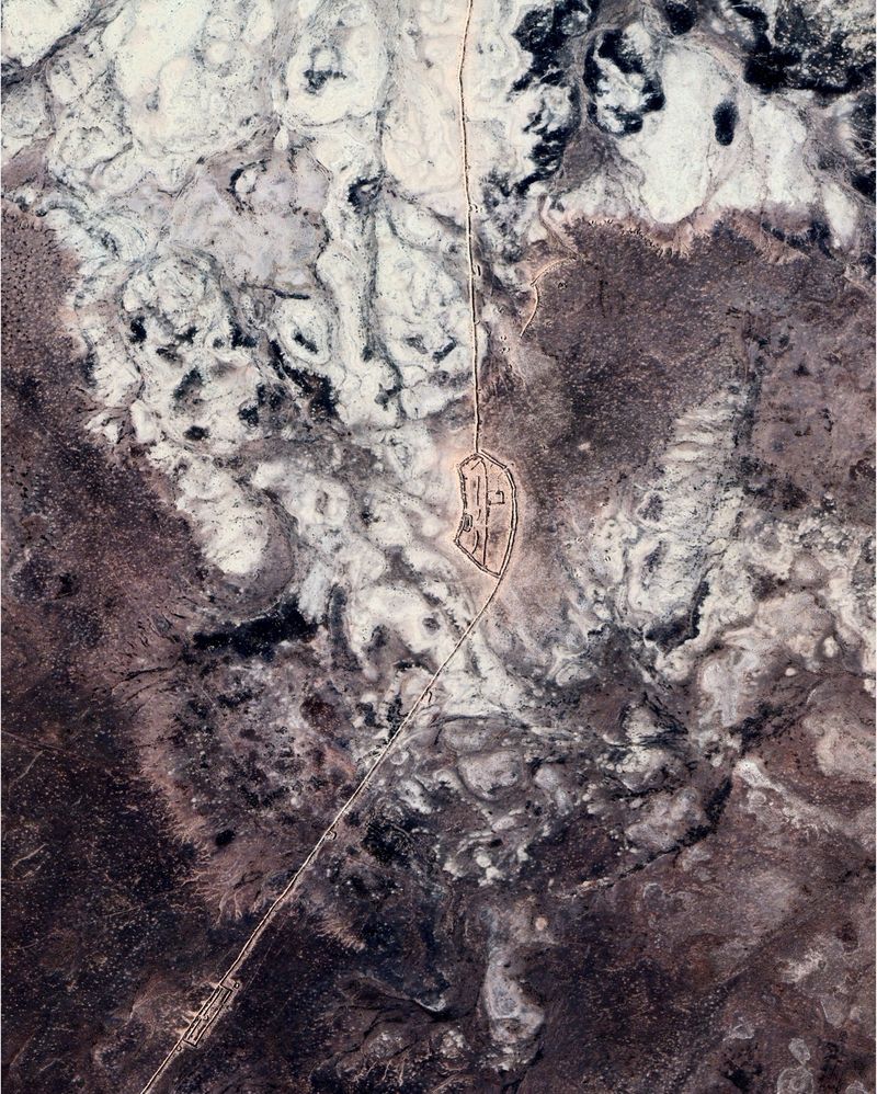
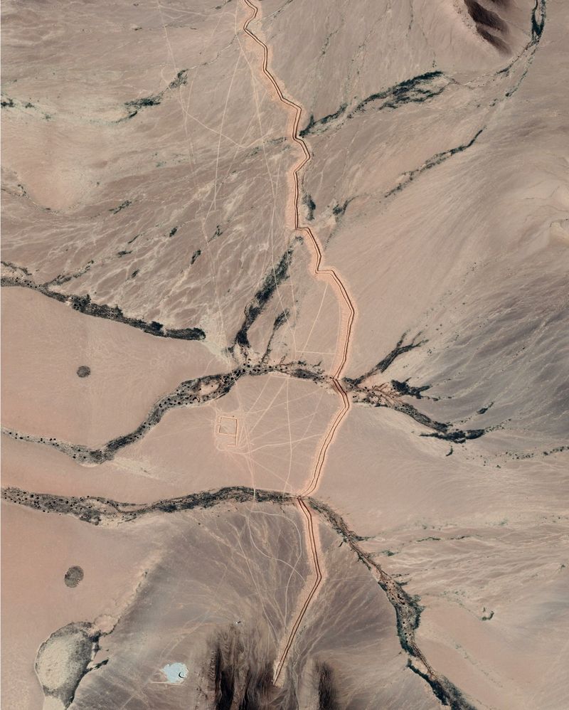
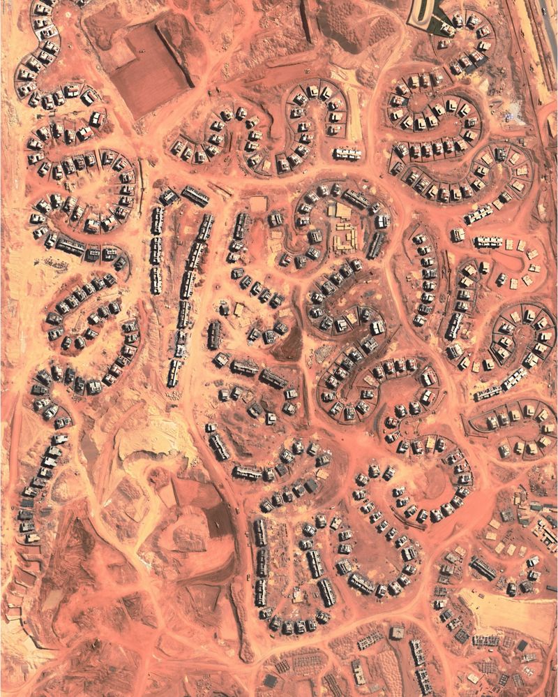
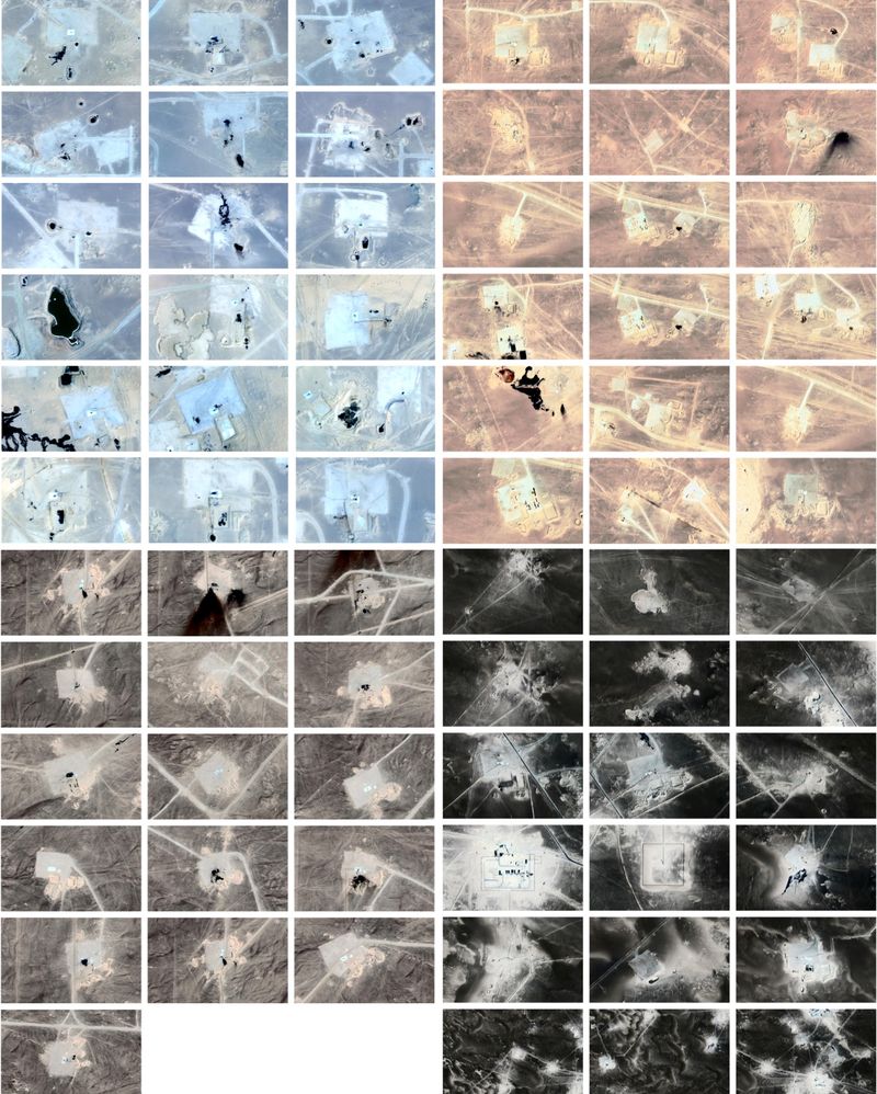
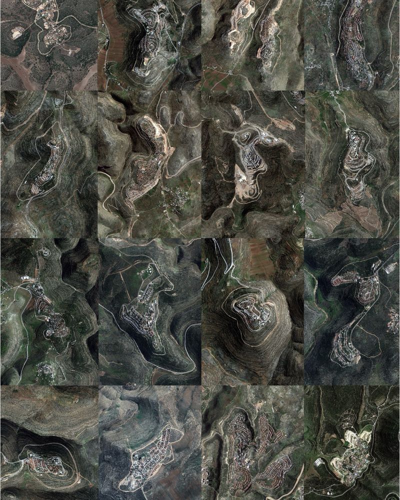
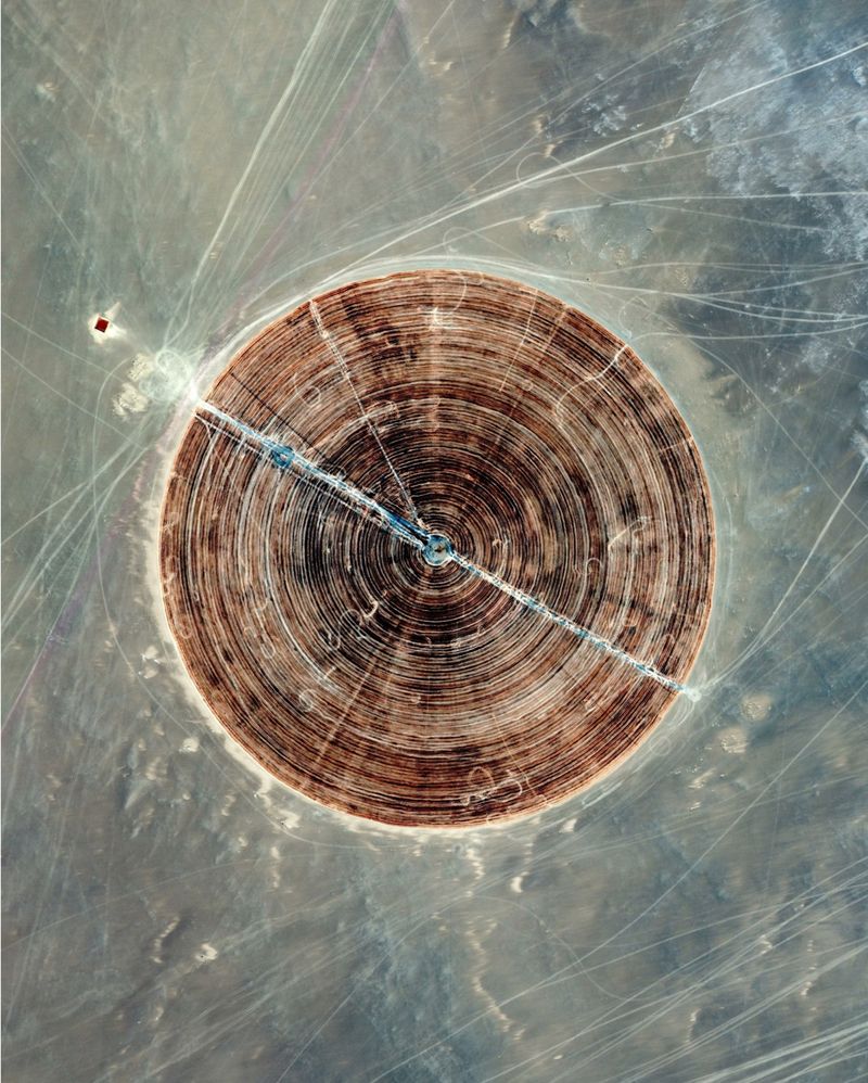
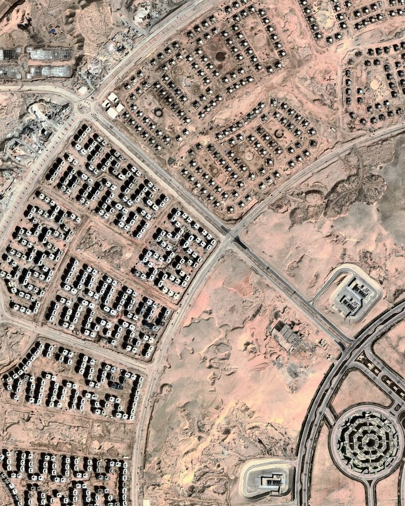
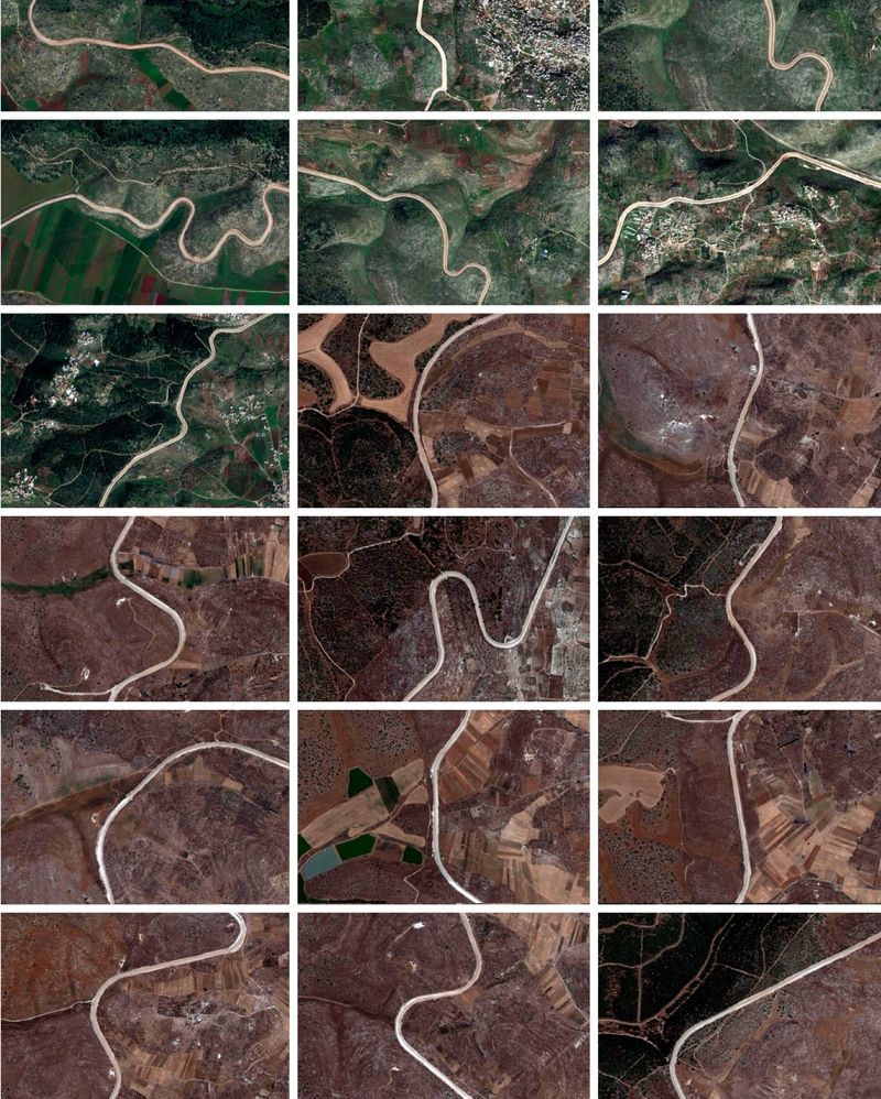
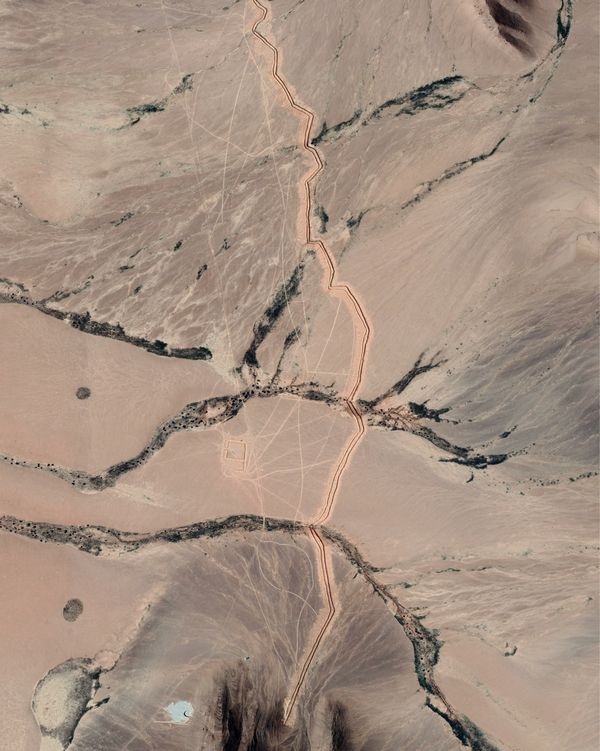
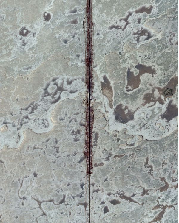
"Geography of Domination" is a poetic attempt to observe the materiality of human violence through the analysis of satellite images. The strategies of controlling resources, territories, and populations leave profound marks on the ground, to the extent that the world's violence can be read in the absence of humans, by examining the earth's contours and the scars left on the surface by bombings, excavations, fences and walls. These images, bordering on abstraction, blur the boundaries between large and small scales, prompting questions about the ability of new technologies to render the world more intelligible. The documentation of the images, written in collaboration with specialists, anchors these abstract images in reality.

This project explores the possibilities offered by satellite imagery : it takes the form of still images, a series of loop videos and a an interactive installation. The installations consists of a two meter LED screen equipped with a distance sensor. Videos, created from morphing several images from different dates, will scroll forward or backward depending on the distance between the visitor and the screen. In other words, the closer the visitor gets to the screen, the further they advance through time.

It is organized in three main chapters which refers to three layers of control : 'Infrastructures' gathers images relative to control of underground ressources such as oil, gas and water. It talks about self dispossession of our food and energy supplies. 'Metastructures' refers to the control of the territory itself. It gathers images of traces of territorial conflicts and border walls. 'Superstructures' observes urbanism as a tool for controlling populations.

© Paul Mesnager - Image from the Geography of Domination photography project
i

Morocco-Algeria wall. The walls at the border between Morocco and Algeria consist of a series of physical barriers erected along the land border between the two countries. These walls were constructed for various reasons, including controlling cross-border movements, preventing smuggling, and ensuring national security.The construction of these walls began in the 1980s, primarily in response to

© Paul Mesnager - Image from the Geography of Domination photography project
i

Oil field, Oman. Seismic exploration involves creating underground ultrasounds using trucks equipped with vibrating plates, which allow for mapping of different geological layers. In most cases, nothing is found. That’s why oil exploration leaves behind a large number of traces. In these images, you can observe the traces left by the trucks crisscrossing the area.

© Paul Mesnager - Image from the Geography of Domination photography project
i

Saudi Arabia-Irak border. Erected in 2014, this barrier extends 900 kilometers, consisting of a combination of fences, concrete walls, watchtowers, and ditches. It is equipped with surveillance cameras, motion sensors, and radars, aiming to prevent militant infiltrations and to control the flow of people and goods.

© Paul Mesnager - Image from the Geography of Domination photography project
i

Oil field, Oman. Seismic exploration involves creating underground ultrasounds using trucks equipped with vibrating plates, which allow for mapping of different geological layers. In most cases, nothing is found. That’s why oil exploration leaves behind a large number of traces. In these images, you can observe the traces left by the trucks crisscrossing the area.

© Paul Mesnager - Image from the Geography of Domination photography project
i

Located around the city of Atme in Syria, these refugee camps are sometimes referred to as the "Olive Grove Camp" because the initial Syrian refugees who failed to reach Turkey settled among the olive trees. This small patch of territory is the last refuge for the entire northern Syria, as it is believed to be too close to the Turkish border to be bombed.

© Paul Mesnager - Image from the Geography of Domination photography project
i

The octagon,Egypt new ministry of defense. The headquarters spans an expansive area of 22,000 acres, with approximately 50,500,000 square feet dedicated to floor space. Comprising 13 distinct zones, each with its designated function, it stands as the largest defense headquarters and office complex globally, surpassing even the renowned Pentagon in the United States.