BALTEO

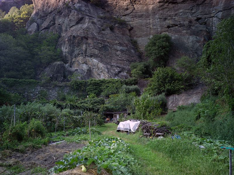
Balteo is the name of the large glacier existing in the Aosta Valley at the end of the last glaciation, from which the river that crosses this region of north-west Italy takes its name. The image cover is a hand made garden glacier.

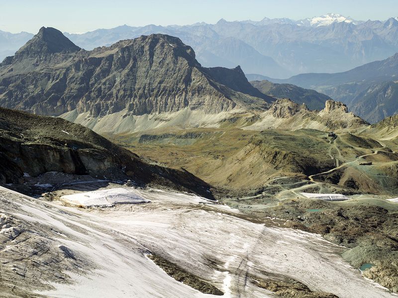
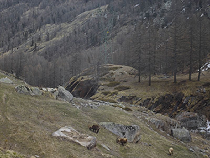
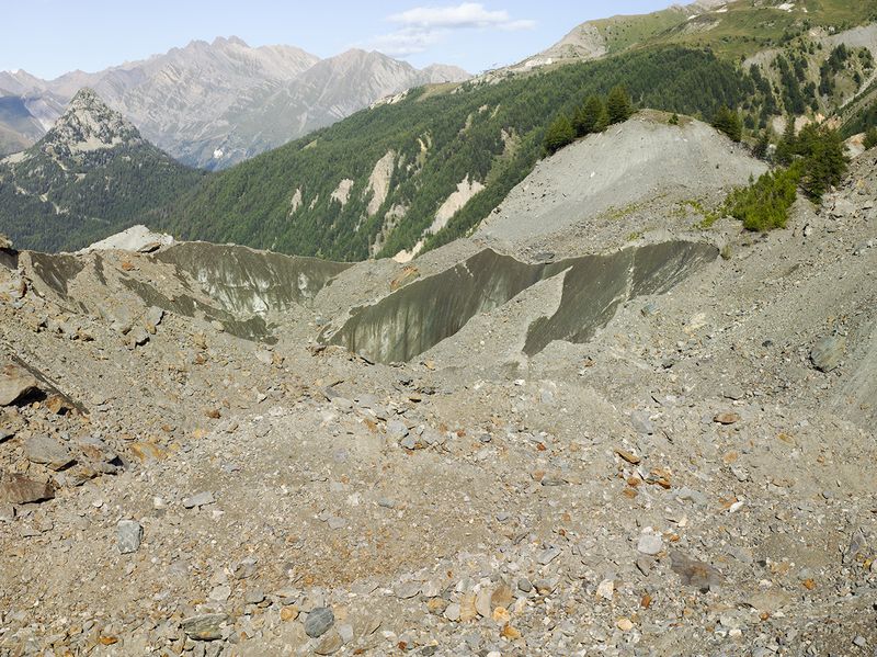
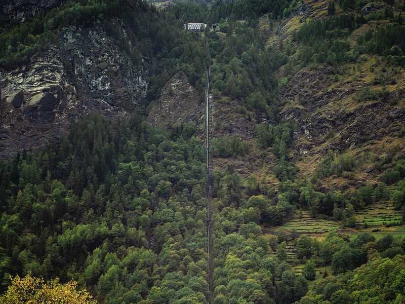
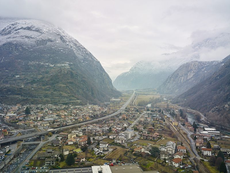
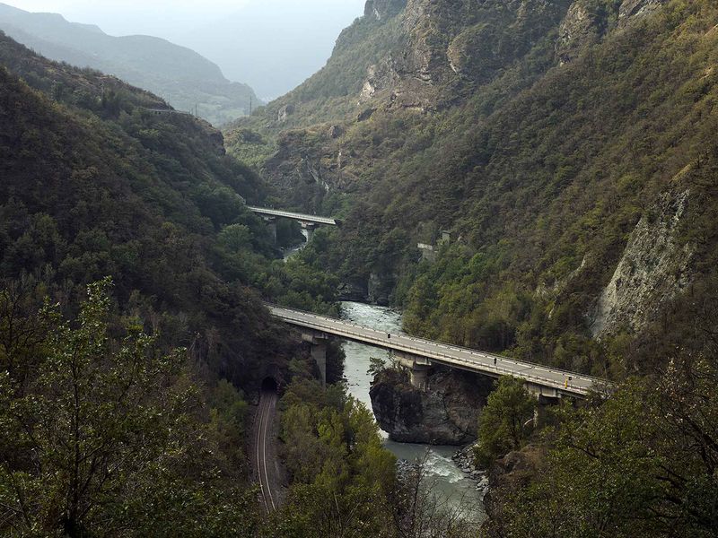
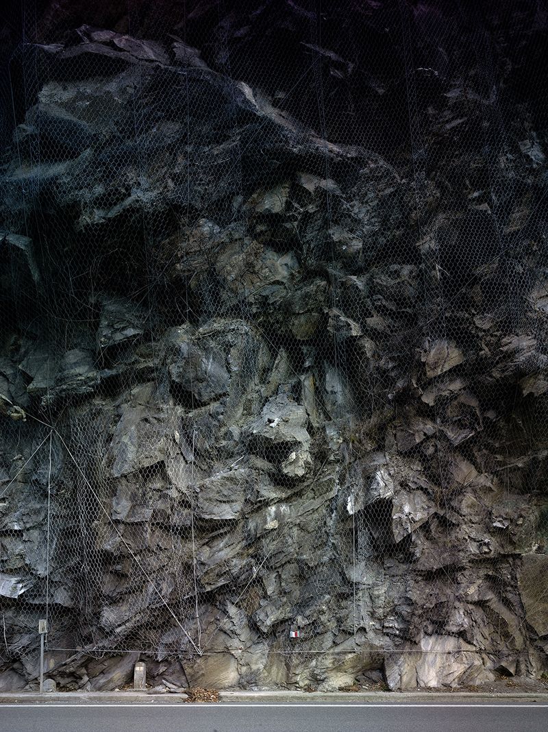
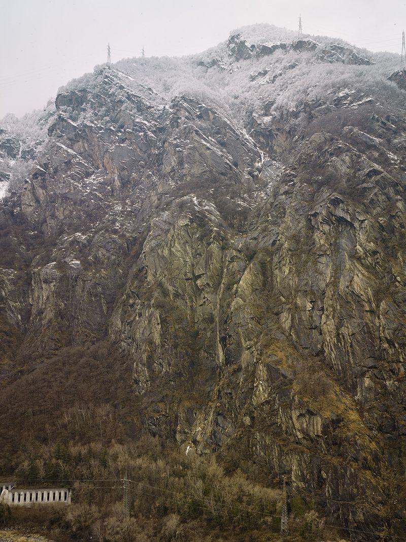
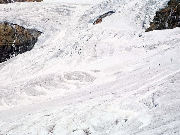
This is a descent starting from the altitude of the glaciers and peaks of the Alps, descending into the side valleys to converge in the central valley of the Aosta Valley, a landscape sculpted and pressed into and onto the rock, where during the last glacial era it hosted the large Blateo glacier from which the main river of the northwest Italy region takes its name. The thickness of the old glacier reached 1000m.

We descend the rocky walls covering a negative altitude difference of more than 3500m, where the landscape changes from icy to a subalpine climate.

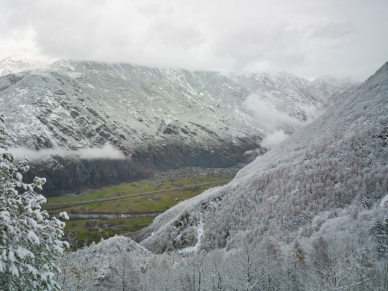
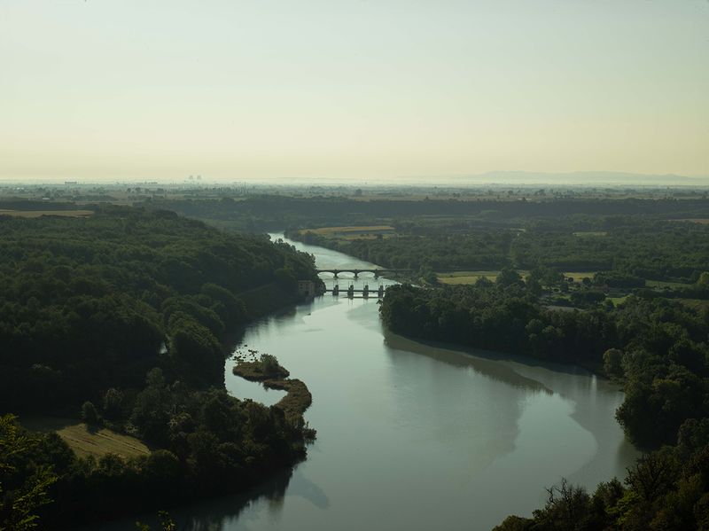
be able to imagine the great Balteo Glacier which extended for 116 km from Mont Blanc to Mazzè (TO) one thousand meters high

it progressed slowly, bringing with it debris and smoothing the central valley, which it hosts

most of the inhabitants of the Aosta Valley.

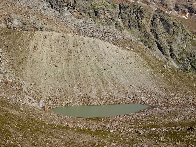
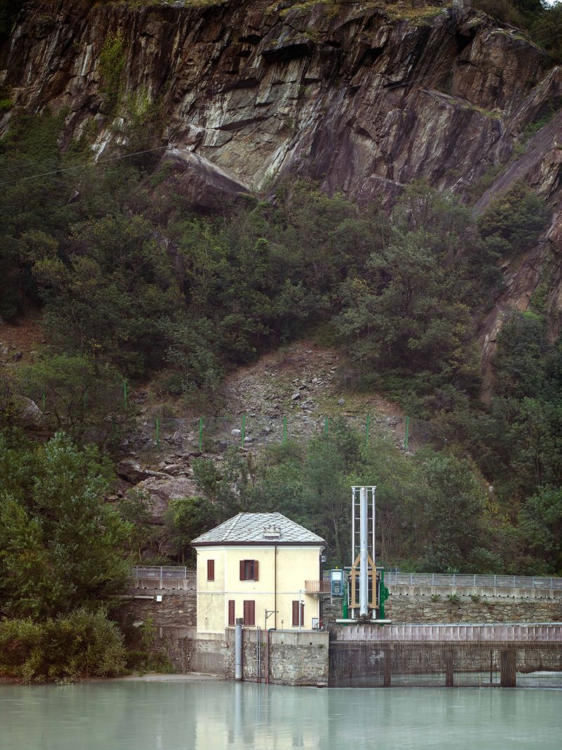
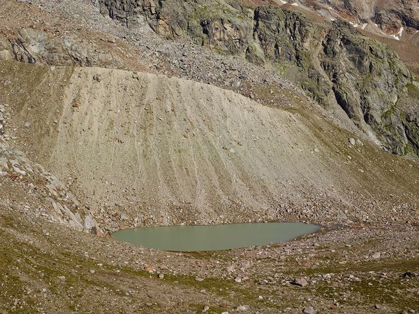
The Great Balteo Glacier is no longer there, but i we can find traces of its passage, wild and anthropized places.

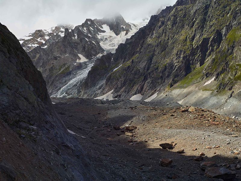
We begin the descent from the highest glaciers of the Valle D'Aosta proceeding towards the south-east. Here In the last two million years several glacial phases have occurred,

during which the glaciers increased in size and progressed

downstream, alternating with as many interglacial phases of regression

characterized by a warmer climate.It dates back to about 150,000 years ago one of the greatest expansions of the Balkan glacier that along the valley axis of Valle D'Aosta welcomed the languages of the side valleys and the Canavese plain going to form the great morainic amphitheater of Ivrea

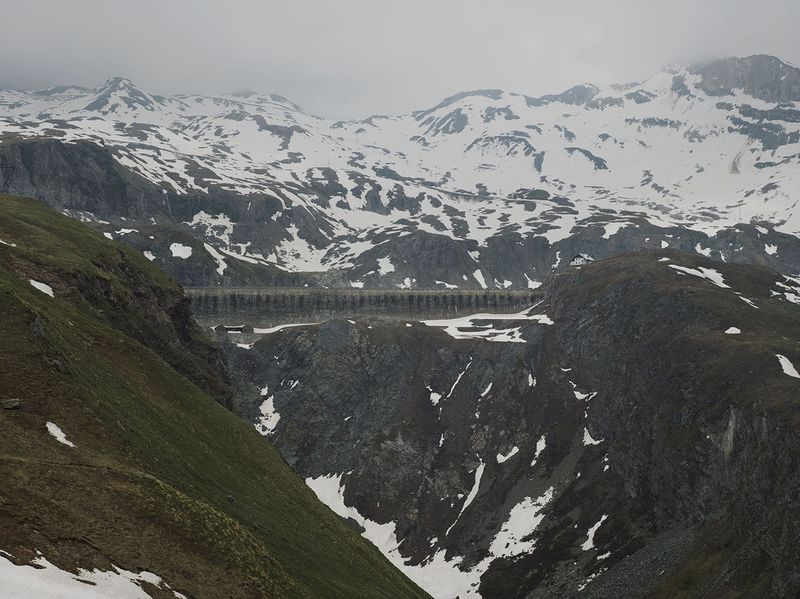
extending over 500 square kilometres.

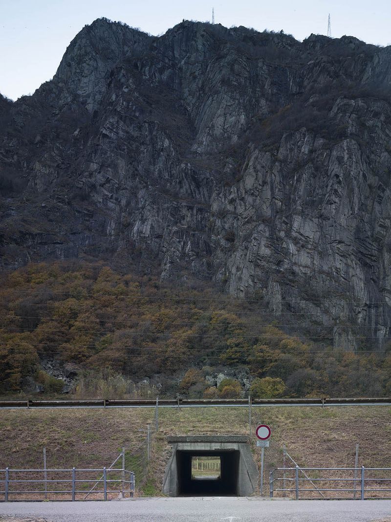
Daily we live immersed in a huge bobsleigh track with rock walls and trees,

our horizon begins very high, and if this sometimes seems stifling others could not physically do without,

a feeling of protection and maybe closure that never makes us forget how imperceptible we are in size compared to our container.

© Mattia Paladini - Grande Ghiacciaio di Verra 3425m slmAlpinisti in cordata.
i

Grande Ghiacciaio di Verra 3425m slmAlpinisti in cordata.

© Mattia Paladini - Teodulo glacier 11km long and snow farming for the World Cup ski race. On the bord Italy/Switzerland. 3500m slm.
i

Teodulo glacier 11km long and snow farming for the World Cup ski race. On the bord Italy/Switzerland. 3500m slm.

© Mattia Paladini - Natural buffer on the glacial moraine. "Verra Glacier" Val D'Ayas 3100m slm.
i

Natural buffer on the glacial moraine. "Verra Glacier" Val D'Ayas 3100m slm.

© Mattia Paladini - Image from the BALTEO photography project
i

The largest black glacier in the Italian Alps originates on Mont Blanc and extends for more than 10km. It sees just under 5 square km of its ablation tongue completely covered by rocky.Point of origin of Great Balteo Glacier. 2300/2400m slm.

© Mattia Paladini - Image from the BALTEO photography project
i

The Goillet lake dam, completed in 1947, has a height of 48.60 m and a reservoir that has a useful capacity of over 11 million cubic meters of water. Located in Valtournenche. 2516m slm.

© Mattia Paladini - "Pont of Valsavarenche" 1990m slm. Ibexes grazing.Gran Paradiso National Park
i

"Pont of Valsavarenche" 1990m slm. Ibexes grazing.Gran Paradiso National Park

© Mattia Paladini - Forced conduit for the production of electricity.Centrale di Maën Perrères in funzione dal 1928. 1300m slm.Jump of 483m
i

Forced conduit for the production of electricity.Centrale di Maën Perrères in funzione dal 1928. 1300m slm.Jump of 483m

© Mattia Paladini - view of alluvional plain from the rock of Bard, motorway and Hône town. 360m slm.
i

view of alluvional plain from the rock of Bard, motorway and Hône town. 360m slm.

© Mattia Paladini - Image from the BALTEO photography project
i

Vegetable garden, the geosite of Bard, inhabited since the Neolithic Age the rocky walls reveal how the erosion of the Balteo Glacierwas powerful, in Roman times here passed the Via delle Gallie. 360m.

© Mattia Paladini - Image from the BALTEO photography project
i

Highway A5, the section between Verrès and Chatillon opened on August 16, 1968. Viaducts on the Dora Baltea and railway.Containment nets on SS26.450m slm.

© Mattia Paladini - Verres, Issogne, Arnad, alluvional plain. 389m slm
i

Verres, Issogne, Arnad, alluvional plain. 389m slm

© Mattia Paladini - National street 26 of Aosta Valley.Containment nets. 380m slm
i

National street 26 of Aosta Valley.Containment nets. 380m slm

© Mattia Paladini - Dam on Dora Baltea river, the narrower passage of Aosta Valley.Rocky spur. 360m slm
i

Dam on Dora Baltea river, the narrower passage of Aosta Valley.Rocky spur. 360m slm

© Mattia Paladini - Motorway tunnel on the natural border of Aosta Valley. 400m slm.
i

Motorway tunnel on the natural border of Aosta Valley. 400m slm.

© Mattia Paladini - Image from the BALTEO photography project
i

barramento sulla Dora Baltea a Mazzè in Provincia di Torino, 116km from Mont Blancup to here extended the Balteo Glacier. 323m asl.

Latest Projects

Sign up to our weekly newsletter

Stay in the loop


We will send you weekly news on contemporary photography. You can change your mind at any time. We will treat your data with respect. For more information please visit our privacy policy. By ticking here, you agree that we may process your information in accordance with them. This site is protected by reCAPTCHA and the Google Privacy Policy and Terms of Service apply.