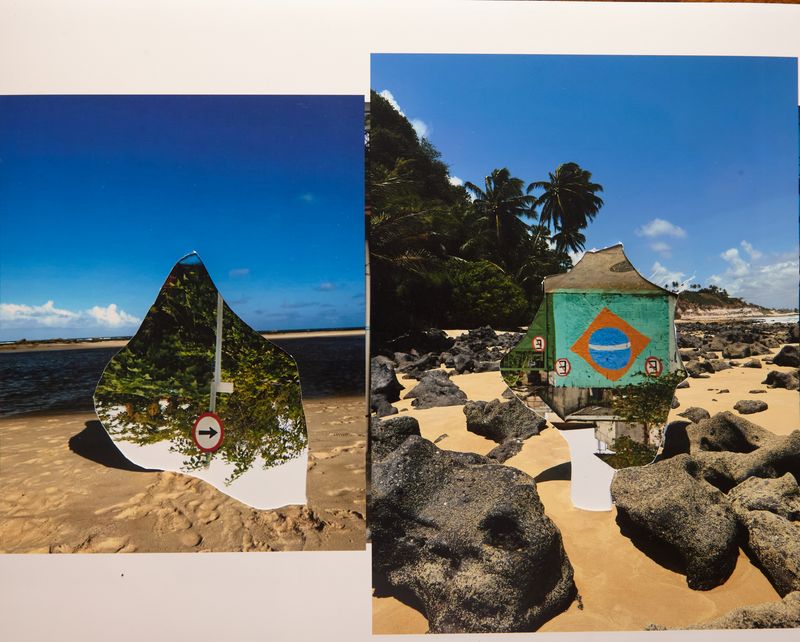
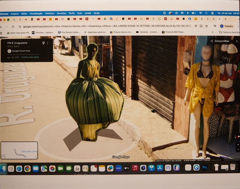
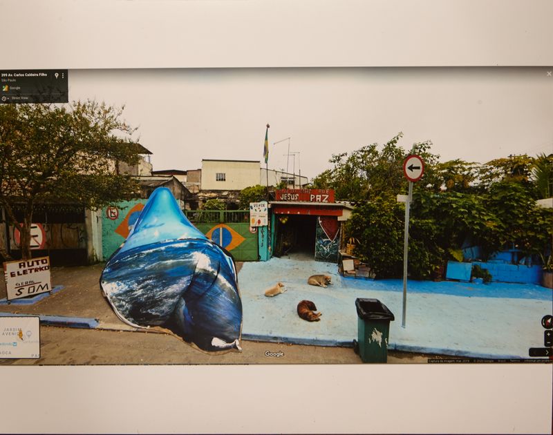
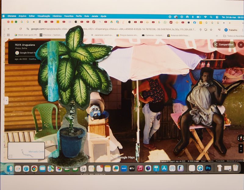
“atlas”
-
Dates2025 - 2026
-
Author
- Location Brazil
Inspired by Massimo Cacciari’s notion of the archipelago, the work frames fragmentation as a connective force, building visual bridges between peripheral landscapes, digital drift, and imagined territories through layered photographic assemblage.
“atlas”
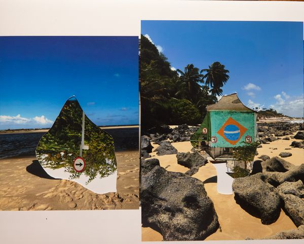
Inspired by Massimo Cacciari’s notion of the archipelago, the work approaches fragmentation as a condition of connection. Within a landscape marked by digital dispersion and increasingly tense borders, the image is investigated as a multiple territory: visual islands linked through displacement and proximity.
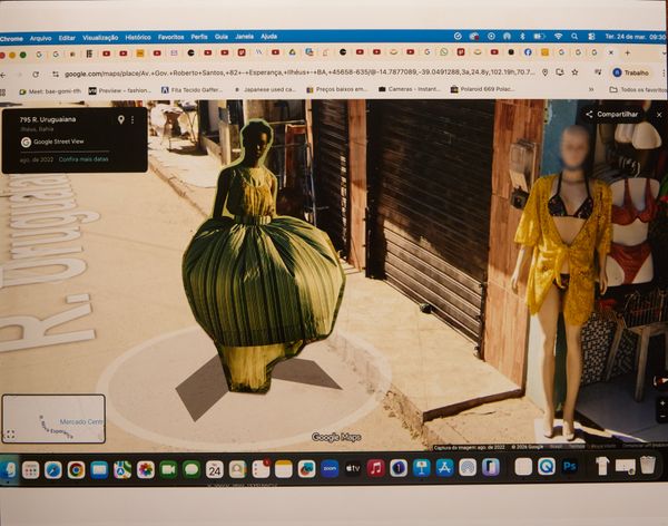
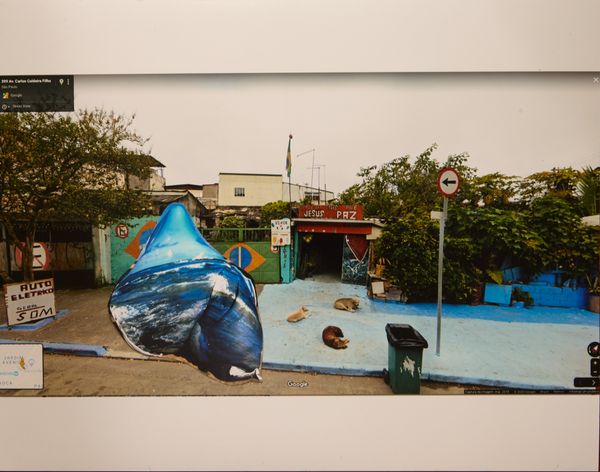
The project originates from the research and collection of landscapes and fragments captured through Google Maps, focusing on peripheral territories whose aesthetics — often marginal, residual, or situated outside normative centers — guide the selection process. These fragments are chosen for their visual affinity and their potential for symbolic displacement. Enlarged onto photographic paper, the images become the ground for manual interventions: collages composed with archival photographs that are printed, cut, layered, and reassembled. The process articulates different scales, temporalities, and origins, constructing a hybrid geography between the virtual, the real, and the imaginary.
Technique and process: digital image capture via Google Maps; enlargement on photographic paper; manual collage using printed photographic archives; digital re-photography of the final composition, resulting in a unique digital image.
Each technique functions as an “island,” separated by language, temporality, and materiality. Collage operates as a bridge, connecting these territories while constructing new visual pathways.
“ARCHIPELAGO” proposes a sensitive cartography in which fragments become interdependent. We are islands joined together: distance does not prevent encounter, but rather makes it possible.