When the Landscape is Quiet Again

North Dakota's Oil Boom

“We do not want to halt progress. We do not plan to be selfish and say ‘North Dakota will not share its energy resource.’ No, we simply want to insure the most efficient and environmentally sound method of utilizing our precious resources for the benefit of the broadest number of people possible. And when we are through with that and the landscape is quiet again…let those who follow and repopulate the land be able to say, our grandparents did their job well. The land is as good and in some cases better than before.” -North Dakota Governor Art Link, 1973

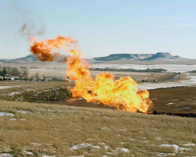
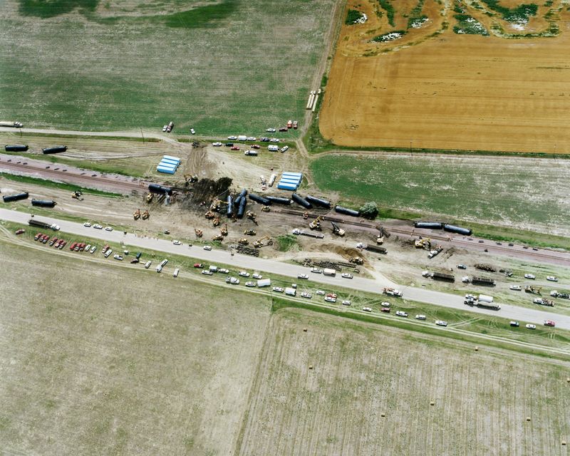
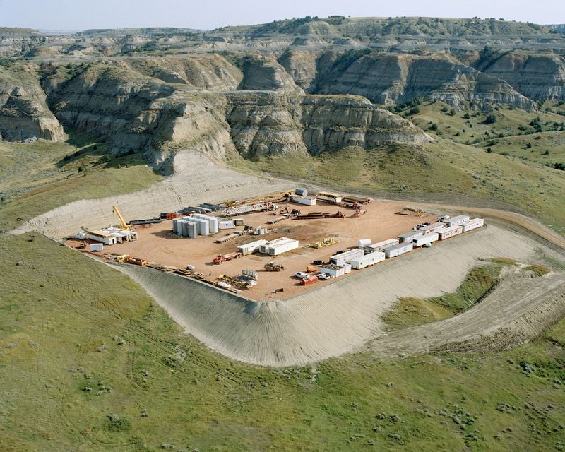
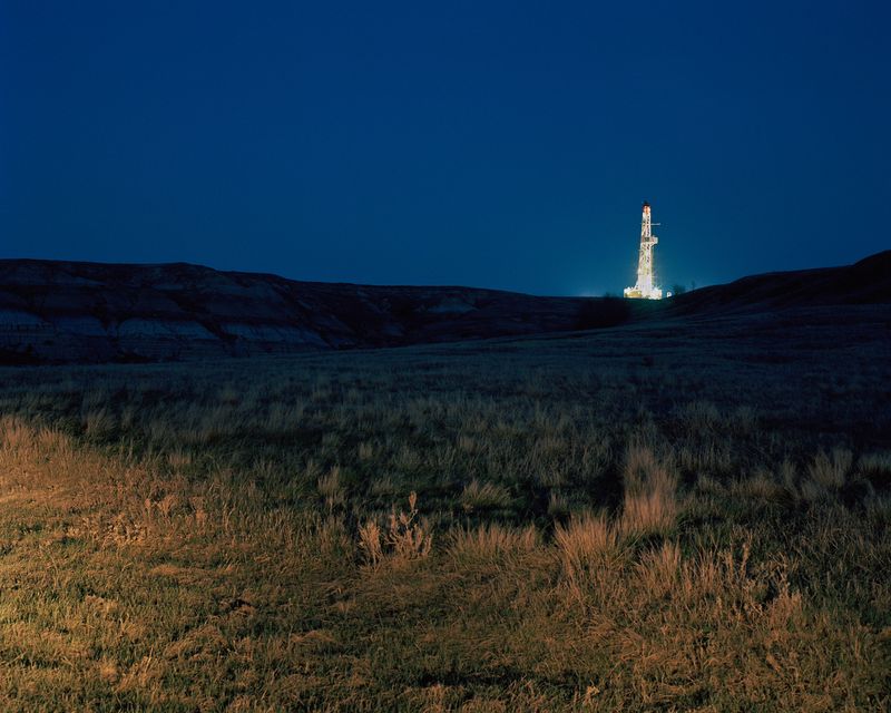
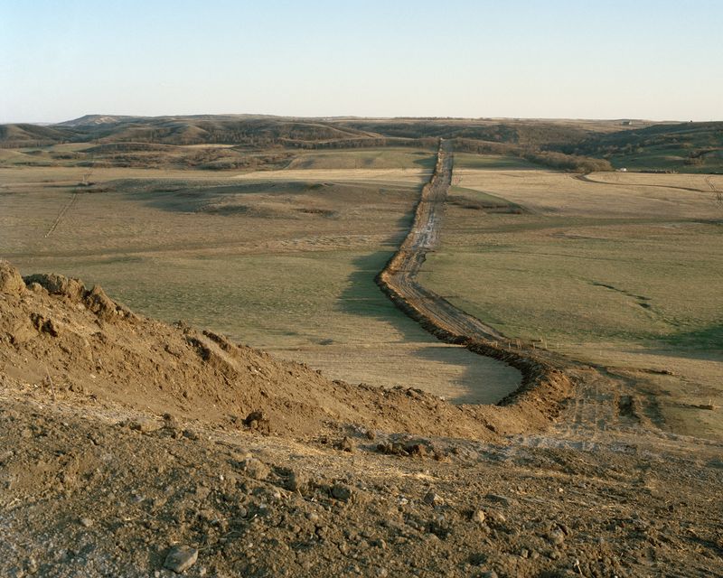
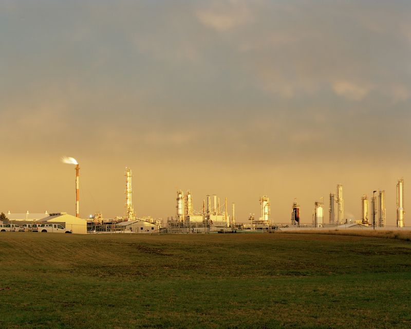
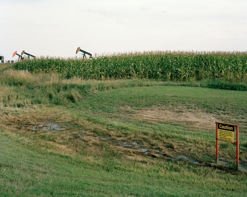
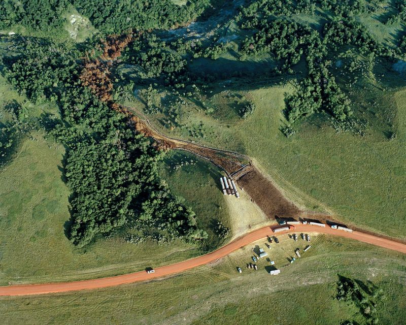
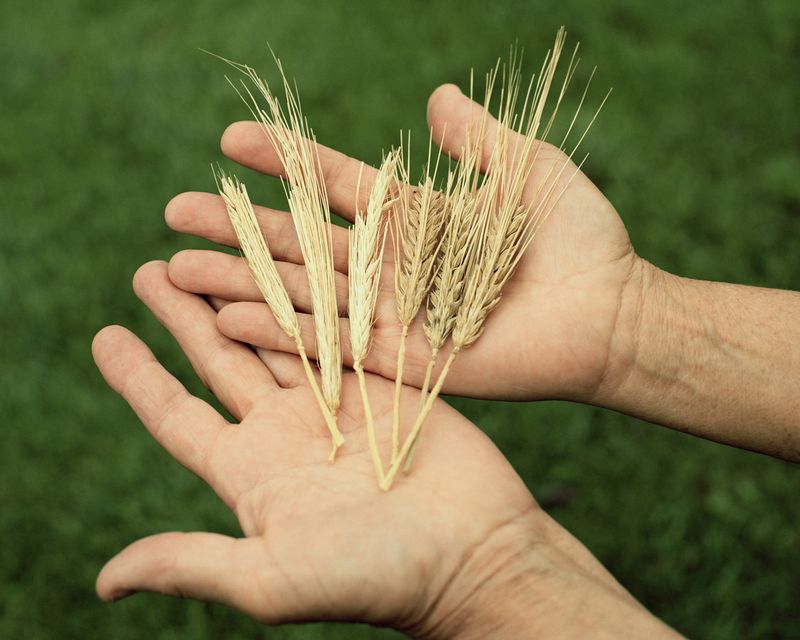
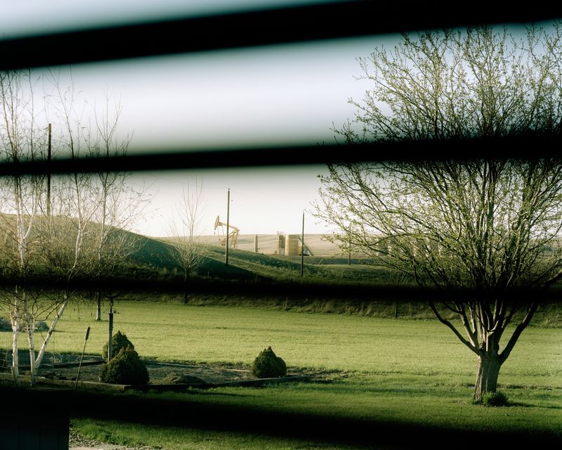
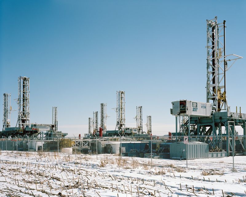
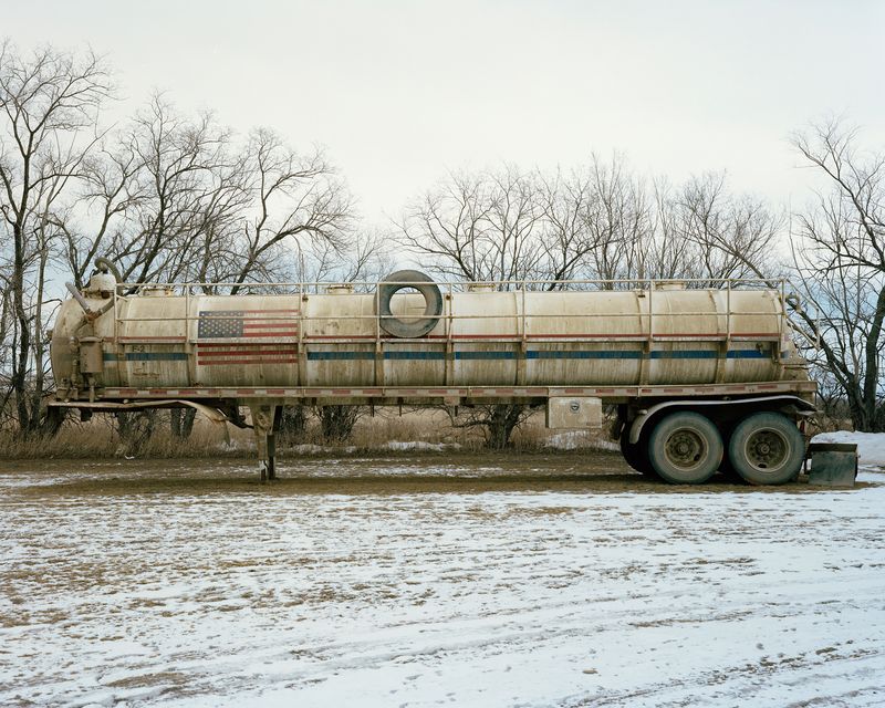
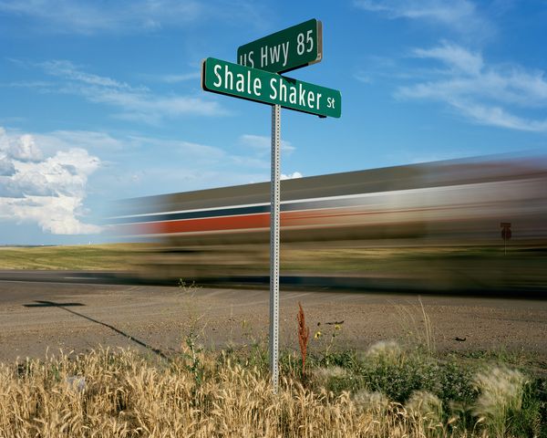
Since 2012, I have been documenting the legacy of oil booms and busts in my home state and how the region is changing again today due to horizontal drilling and hydraulic fracturing. My photographs bear witness to the transformation of western North Dakota’s quiet agrarian landscape into an industrial zone dotted with well sites, criss-crossed by pipelines, lit up by natural gas flares, and contaminated by oil and saltwater spills. The Bakken oil field is currently pumping out over a million barrels per day from over 13,000 active wells, making North Dakota the No. 2 oil-producing state in the nation behind Texas.

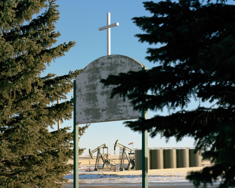
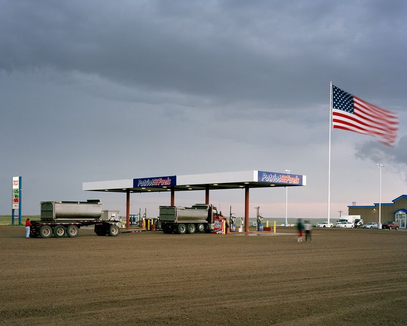
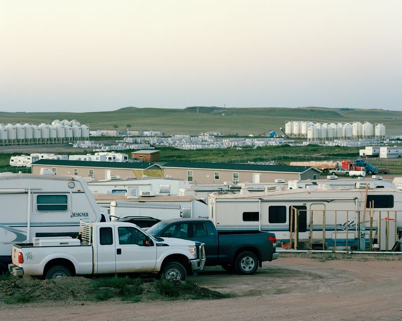
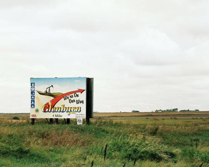
These activities have brought a steady stream of revenue, people, and jobs to this economically depressed region. Everyone wants a piece of the action, including my family: since the start of the boom we have been profiting from oil wells drilled on the land my great-grandparents homesteaded in 1912. Although many other families are doing the same, I am still torn: what are the hidden costs of this prosperity?

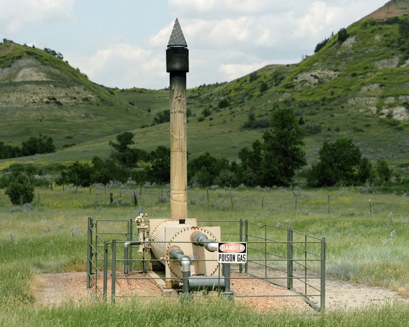
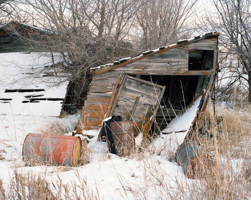
Experts originally anticipated that the Bakken Boom would continue for several decades, but falling oil prices have triggered another bust—the third to happen in the state. I examine the scars from North Dakota’s prior boom-and-bust cycles and the new wounds being inflicted upon my home because the status quo must change: something needs to be left for the next generation, not the next quarter.

Acknkowledgments:

This project was funded by an Individual Artist Commission grant of the San Francisco Arts Commission and an Investing in Artists grant from the Center for Cultural Innovation. Additional support was provided by RayKo Photo Center and in-the-field assistance was given by the Dakota Resource Council, the Killdeer Mountain Alliance, the Northwest Landowners Association, and numerous other individuals.

© Sarah Christianson - Image from the When the Landscape is Quiet Again photography project
i

Shale Shaker Street. North Dakota's oil is trapped in small pockets within the dense shale rock of the Bakken formation. To unlock the oil, wells are drilled horizontally through these layers and fracked with a high-pressure mix of water, sand, and chemicals.

© Sarah Christianson - Image from the When the Landscape is Quiet Again photography project
i

Flaring near the Blue Buttes. Natural gas is being flared off in North Dakota due to a lack of infrastructure. It is cheaper for companies to waste the gas than it is for them to secure easements for pipelines that would transport the gas to processing facilities. Before new policies were adopted in 2014, upwards of 30% of the state's natural gas was being flared.

© Sarah Christianson - Image from the When the Landscape is Quiet Again photography project
i

BNSF oil train derailment near Culbertson, MT, July 2015. Unlike the 2013 derailment in Lac-Mégantic, Quebec, the 22 oil tank cars here did not explode when they jumped the tracks. However, four of them leaked approximately 35,000 gallons of oil into the surrounding landscape.

© Sarah Christianson - Image from the When the Landscape is Quiet Again photography project
i

Well site carved out of the bluffs near the Badlands. The Lakota called this area "mako sica" or "land bad." French-Canadian fur trappers did the same, claiming these were "bad lands to travel through" because of the rugged terrain. Although no drilling is taking place within Teddy Roosevelt National Park, the noises and sight of oil development along its borders are clear.

© Sarah Christianson - Keene First Lutheran Church.
i

Keene First Lutheran Church.

© Sarah Christianson - Drilling rig near the Little Missouri National Grasslands.
i

Drilling rig near the Little Missouri National Grasslands.

© Sarah Christianson - Patriot Fuels.
i

Patriot Fuels.

© Sarah Christianson - Image from the When the Landscape is Quiet Again photography project
i

Man camp and frack sand depot, McKenzie County, July 2014. Temporary camps like this--full of RVs, trailers, and prefab structures--were set up to accommodate the influx of workers that flocked to the region for high-paying jobs.

© Sarah Christianson - Image from the When the Landscape is Quiet Again photography project
i

The Badlands south of Medora, July 2014. Infrastructure from the two prior boom-and-bust cycles can still be found across the state.

© Sarah Christianson - Image from the When the Landscape is Quiet Again photography project
i

Pipeline through Brenda & Richard Jorgenson’s land, May 2013. The Jorgensons fought to keep this 12 inch, 2200psi natural gas pipeline off their land. Their ranch was homesteaded by Richard’s grandfather in 1915, and they want to safeguard it for future generations of their family. When they refused to sign easement papers granting access and approval for the project, Alliance Pipeline seized their land through eminent domain. They now refer to the line that runs to Tioga as “the bomb in the backyard.”

© Sarah Christianson - Tioga Natural Gas Plant.
i

Tioga Natural Gas Plant.

© Sarah Christianson - Image from the When the Landscape is Quiet Again photography project
i

Blue Buttes Waste Facility near the Ft. Berthold Reservation, July 2015. This 60-acre landfill accepts non-hazardous oilfield waste. It will take approximately 25 years to fill, at which point everything will be buried, reclaimed, and monitored for another 30 years.

© Sarah Christianson - Image from the When the Landscape is Quiet Again photography project
i

Corn field near Antler, ND. "Caution: Hazardous chemicals may be present in this area. Failure to use caution may cause serious injury or illness!"

© Sarah Christianson - Image from the When the Landscape is Quiet Again photography project
i

1 million gallons of saltwater spilled, Ft. Berthold Reservation, July 2014. This toxic wastewater flowed downhill over two miles to Lake Sakakawea, leaving a swath of dead trees and vegetation in its wake. Tribal officials do not believe the contamination reached their water supply, thanks to a series of beaver dams in the ravine. However, scientists at Duke University have released a report indicating otherwise. Investigations by the EPA are still ongoing.

© Sarah Christianson - Image from the When the Landscape is Quiet Again photography project
i

Barley from Artz’s saltwater-damaged field, September 2013. Saltwater, also called brine or produced water, is a natural byproduct of oil extraction. Despite the benign name, it is highly toxic: this water is 5-10 times saltier than the ocean and contains traces of heavy metals. It burns the land, leaving healthy agricultural production impossible. The stunted growth of the barley heads (left) indicate that saltwater had been leaking into Artz's field for several weeks without detection.

© Sarah Christianson - Image from the When the Landscape is Quiet Again photography project
i

The Skogens’ bedroom window, near Cartwright. For oil wells drilled near homes, the current minimum setback distance is 500 feet. Many homeowners are fighting to have this setback distance increased to be at least 1000 feet from homes.

© Sarah Christianson - "We're on Our Way," Glenburn, ND.
i

"We're on Our Way," Glenburn, ND.

© Sarah Christianson - Abandoned shed and oil drums at my great-grandparents' homestead, January 2015.
i

Abandoned shed and oil drums at my great-grandparents' homestead, January 2015.

© Sarah Christianson - Drilling rigs at Five Diamond Industrial Park, Dickinson, February 2016.
i

Drilling rigs at Five Diamond Industrial Park, Dickinson, February 2016.

© Sarah Christianson - Oil tanker north of Williston, February 2016.
i

Oil tanker north of Williston, February 2016.

Latest Projects

Sign up to our weekly newsletter

Stay in the loop


We will send you weekly news on contemporary photography. You can change your mind at any time. We will treat your data with respect. For more information please visit our privacy policy. By ticking here, you agree that we may process your information in accordance with them. This site is protected by reCAPTCHA and the Google Privacy Policy and Terms of Service apply.